Colorado 14ers
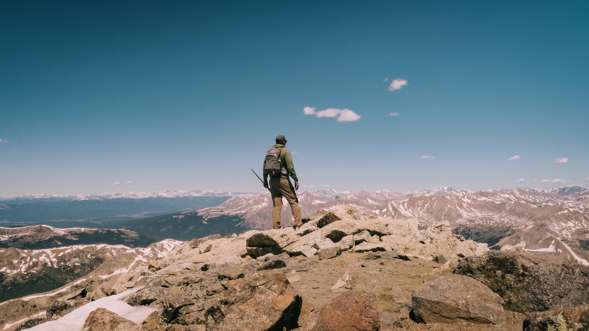
Colorado’s 14ers (peaks over 14,000 feet) offer some of the most spectacular hiking experiences in the United States. With 58 peaks to explore, these mountains challenge hikers with their high elevation, rugged terrain, and unpredictable weather. This guide will provide everything you need to know to prepare for and conquer these iconic summits, including equipment, safety tips, and route recommendations.
HIKING14ERS
Devin
6/25/20253 min read
What is a Colorado 14er?
A 14er is a mountain with an elevation of at least 14,000 feet. Colorado is home to 58 official 14ers, ranging from beginner-friendly hikes to technical climbs. These peaks attract outdoor enthusiasts from around the world for their stunning views, physical challenges, and sense of accomplishment.
Essential Equipment for Hiking 14ers
Preparing for the conditions, prepares you for the success
Backpack
Capacity: 20-30 liters for day hikes. Include a hydration reservoir or water bottles.
Clothing
Base Layers: Moisture-wicking shirts and pants.
Mid Layers: Fleece or insulated jacket.
Outer Layers: Waterproof and windproof shell.
Accessories: Hat, gloves, and sunglasses.Footwear:
Sturdy hiking boots or trail runners with good grip.
Navigation Tools
Topographic map and compass.
GPS device or smartphone app (download maps offline).
Safety Gear
First-aid kit.
Headlamp with extra batteries.
Emergency blanket.
Whistle and multi-tool.
Trekking Poles
Help with stability and reduce strain on knees.
Food and Water
High-calorie snacks and a packed lunch.
At least 2-4 liters of water per person.
Water filtration system in case you need to refill from natural sources.
How to Find and Choose a 14er
Beginner-Friendly Peaks
Start with Class 1 routes that are well-marked and have minimal technical challenges.
Proximity
Peaks closer to Denver or Colorado Springs are easier for day trips but are more crowded.
Difficulty Levels
Research Class ratings:
Class 1: Well-maintained trails.
Class 2: Steeper with some off-trail hiking.
Class 3: Scrambling with hands required.
Class 4-5: Technical climbing and rope use.
Seasonal Considerations
Summer (July to September) is the best season for 14ers.
Snow and ice can make routes dangerous in other seasons.
Online Resources
Websites like 14ers.com provide detailed route descriptions.
Apps like AllTrails offer trail reviews and GPS mapping.
Safety Tips
Acclimatize
Spend a few days at higher elevations before attempting a 14er.
Be aware of altitude sickness symptoms: headache, nausea, and dizziness.
Start Early
Aim to be off the summit by noon to avoid afternoon thunderstorms.
Check Weather
Monitor the forecast leading up to your hike.
Be prepared to turn back if conditions worsen.
Know Your Limits
Listen to your body and don’t push beyond your capabilities.
Colorado 14ers Listed by Difficulty with Route Information
Class I-Well-groomed, defined trail, no hands needed.
Handies Peak
Southwest Slopes 2500’ 5.75 mi
San Luis Peak
Northeast Ridge 3600’ 13.5 mi
Pikes Peak
East Slopes 7600’ 24 mi
Class II-Steeper, loose rock, may use hands for balance.
Mt. Bross(Private Property)
West Slopes 2250’ 3.25 mi
Mt. Cameron
West Ridge 2250’ 4.75 mi
Mt. Lincoln
West Ridge 2600’ 6 mi
Mt. Bierstadt
West Slopes 2850’ 7.25 mi
Mt. Democrat
East Slope 2150’ 4 mi
Huron Peak
Northwest Slopes 3500’ 7 mi
Culebra Peak
Northwest Ridge 2700’ 5 mi
Mt. Princeton
East Slopes 3200’ 6.5 mi
Redcloud Peak
Northeast Ridge 3700’ 9 mi
Mt. Blue Sky
West Ridge from Summit Lake 2000’ 5.5 mi
Uncompahgre Peak
South Ridge 3000’ 7.5 mi
Humboldt Peak
West Ridge 4200’ 11 mi
Mt. Columbia
West Slopes 4250’ 12 mi
Mt. Yale
Southwest Slopes 4300’ 9.5 mi
Sunshine Peak
Via Redcloud Peak 4800’ 12.25 mi
Missouri Mountain
Northwest Ridge 4500’ 10.5 mi
Mt. Massive
East Slopes 4500’ 14.5 mi
Mt. Oxford
Via Mt. Belford 5900’ 11 mi
Tabeguache Peak
Via Mt. Shavano 5600’ 11.5 mi
Mt. Antero
West Slopes 5200’ 15.5 mi
Mt. of the Holy Cross
North Ridge 5600’ 11.25 mi
Difficult Class II
Windom Peak
West Ridge 3000’ 6 mi
Conundrum Peak
South Ridge 4400’ 13.5 mi
Castle Peak
Northeast Ridge 4600’ 13.5 mi
Ellingwood Point
South Face 6200’ 17 mi
Challenger Point
North Slope 5400’ 13.5 mi
Blanca Peak
Northwest Ridge 6500’ 17 mi
Class III
Mt. Sneffels
South Slopes 2900’ 6 mi
Kit Carson Peak
Via Challenger Point 6250’ 15 mi
Class III-Scrambling with hands, route-finding, mild exposure. Wear a HELMET
El Diente Peak
South Slopes 4400’ 12 mi
Mt. Wilson
Southwest Slopes 4400’ 12.5 mi
North Eolus
South Ridge 250’ 0.2 mi
Wetterhorn Peak
Southeast Ridge 3300’ 7 mi
Mt. Eolus
Northeast Ridge 3100’ 6 mi
Longs Peak
Keyhole Route 5100’ 14.5 mi
Wilson Peak
Southwest Ridge 3900’ 10 mi
Crestone Peak
South Face 5700’ 14 mi
Maroon Peak
South Ridge 4800’ 12 mi
Snowmass Mountain
East Slopes 5800’ 22 mi
Class IV-Steep scrambling, high exposure, rope often recommended. A fall can result in Major Injury or Death
North Maroon Peak
Northeast Ridge 4600’ 9.25 mi
Crestone Needle
South Face 4400’ 12 mi
Sunlight Peak
South Face 3000’ 6 mi
Pyramid Peak
Northeast Ridge 4500’ 8.25 mi
Little Bear Peak
West Ridge and Hourglass 6200’ 14 mi
Capitol Peak
Northeast Ridge 5300’ 17 mi
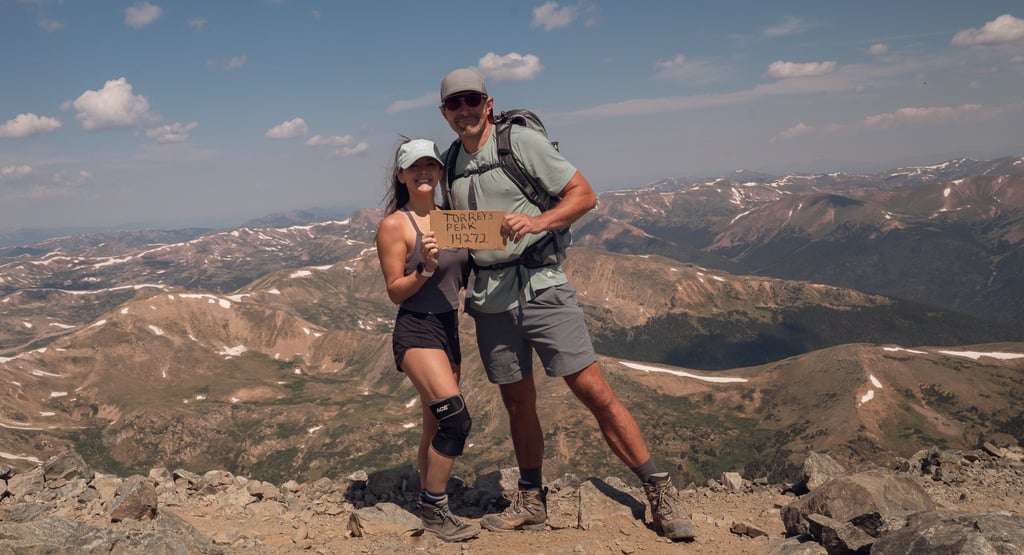
60 million Americans will hike each year
500,000 people will summit a 14,000 foot mountain
.008% of the people that hike will stand at the top of a 14er